google earth
Google has recently released a beta version of its 3D mapping application. Google Earth features satellite imagery of the entire planet, and like Google Maps, it integrates Google search results right onto the globe. It allows you to zoom from space right down to your city, take a virtual tour of the globe.
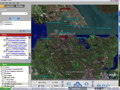
One of the most useful features is layers, which show you restaurants, banks, bars, petrol stations, hospitals and more in the area, all with a single click. You can add or remove layers to suit your search. The tour feature allows you to bookmark and append your own descriptions to numerous places all over the globe.
The free version lacks drawing tools and GPS data import; the Plus version adds these for $40; there's also a $800 Pro version that offers high-resolution printing and emailing of images, up to 2,500 spreadsheet data import points, better support, area measurement and optional add-ons. Also, Goog
 le Earth is only for Windows 2000 and XP.
Google Earth is a mapping and research tool that's both useful and highly addictive. It's extremely flexible, even allowing you to create your own layers. As we saw with Google Maps, users were able to hack in features such as crime statistics and housing prices, and with Google Earth's more powerful engine, it's expected that additional creative features will be unleashed.
posted by Anonymous @ 8:46 pm
0 comments
![]()

0 Comments:
Post a Comment
<< Home